Storm surge scenarios
This app maps the flooding scenarios due to the combined effects of the sea level rise, vertical land motion, highest astronomical tide and storm surge in ordinary or extreme storm wave conditions with regard to specific case studies of SAVEMEDCOASTS and SAVEMEDCOASTS-2 projects. Use the panels below to set the input parameters and then click on the Show on map button to see the resulting scenario on the map and its main features in the lower panels.
Warning: please note that the following maps represent flooding scenarios without considering any adaptation or protection systems (e.g. MOSE in the case of Venice Lagoon). Disclaimer
Case study
IPCC scenario (AR5)
Sea storm return time
Time horizon
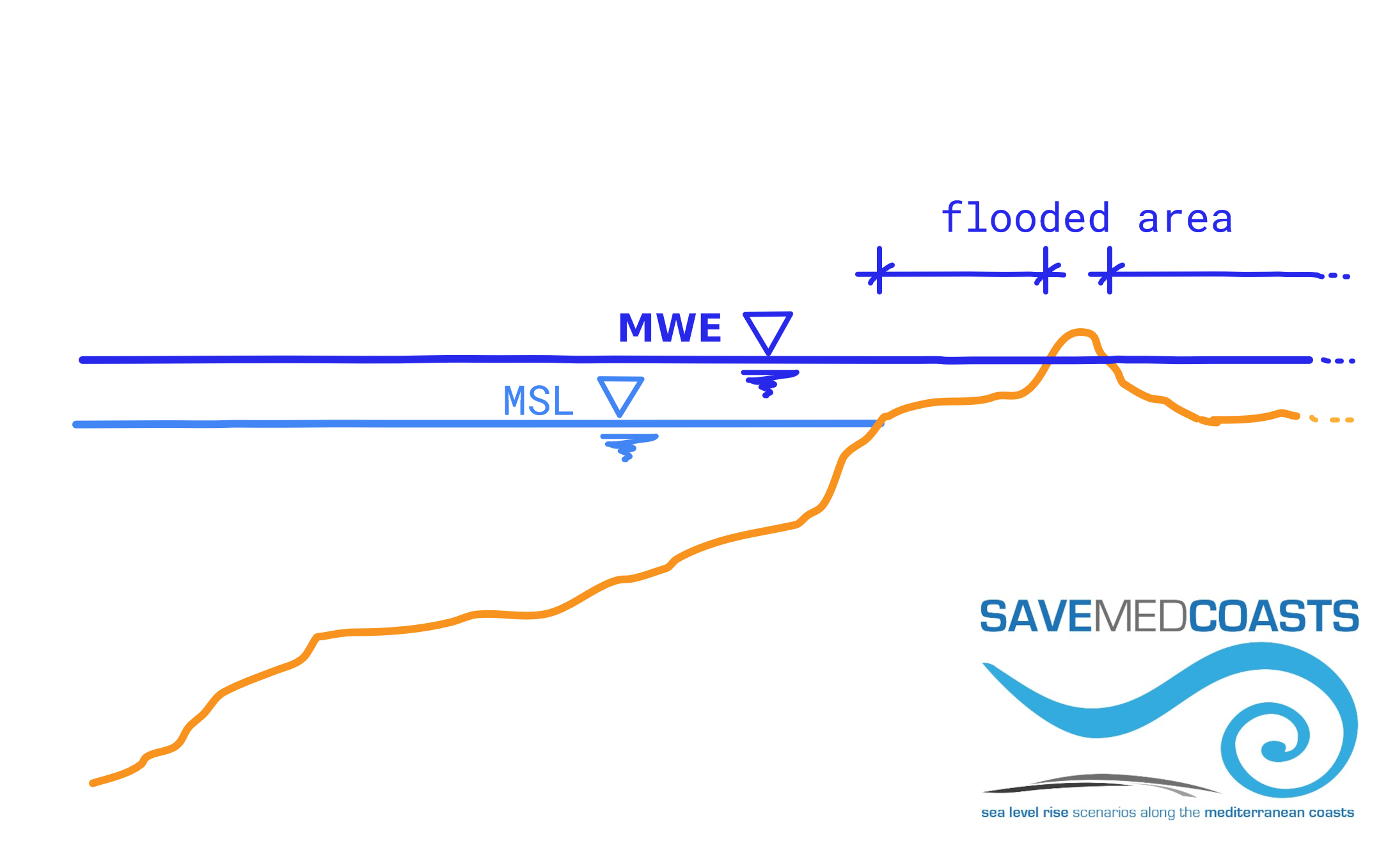
SLR (m)
VLM (m)
HAT (m)
Rmax (m)
MWE (m)
Flooded area (ha)
Glossary:
- IPCC = Intergovernmental Panel on Climate Change
- AR5 = IPCC Fifth Assessment Report
- RCP = Representative Concentration Pathway
- RCP2.6 = low-emissions scenario (mitigation)
- RCP8.5 = high-emissions scenario ("business as usual")
- SLR = Sea Level Rise
- RSLR = Relative Sea Level Rise
- VLM = Vertical Land Motion (negative if subsidence, positive if uplift)
- HAT = Highest Astronomical Tide
- Rmax = Maximum runup due to storm surge (SAVEMEDCOASTS case studies only)
- MWE = Maximum Water/Flood Elevation, calculated as follows: (a) SLR + VLM + HAT + Rmax for the SAVEMEDCOASTS case studies, (b) RSLR + HAT or the overtopping discharge of sea defences, if it occurs, for the SAVEMEDCOASTS-2 case studies.
- MSL = Mean Sea Level
- Flooded area = Potentially flooded area due to MWE